Philadelphia City Hall was the largest masonry load-bearing wall building in the world at the time of its completion in 1901, stood as the tallest occupied building in the United States until 1909, and still is the largest city hall in the United States. The building covers 14.26 acres, originally contained 634 rooms with over 1 million square feet of space, and with its tower and statue of William Penn rises a total of 548 feet above the ground. The construction of Philadelphia City Hall began in 1872 and was completed in 1901.
Civil


Breezewood Harrisburg State: PA Zip: Country: USA Website: http://www.asce.org/project/pennsylvania-tunpike-(old-section)/ Creator: Pennsylvania Turnpike Commission
The Pennsylvania Turnpike was the first American paved highway of the automobile era in which tolls alone were expected to pay all project costs. The 160-mile roadway, which cut an east-west path from Pittsburgh to the state capital of Harrisburg, was considered a revolutionary example of transportation system design and served as a model for the Interstate Highway System.

Water wheels have been used to power mills and pumps for centuries. However, the traditional water wheel was inefficient: water hitting a bucket would splash back against the next bucket, slowing the wheel. This is especially true when water is delivered to the buckets under very high pressure.
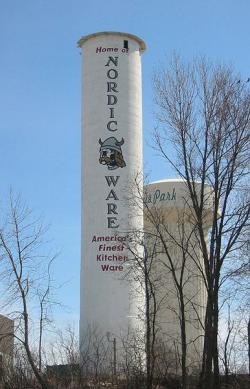
No image dominates the Midwestern landscape like the monolithic grain elevator, whose present shape and construction owe much to grain company operator Frank Peavy and architect-builder Charles Haglin.
Wanting to improve on the flammability and cost of traditional wood-cribbed construction, Peavy speculated that reinforced concrete, in its infancy at the turn of the century, would outperform other materials. But critics feared that the elevator would collapse due to the vacuum created when grain was emptied from the air-tight structure.
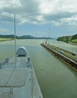
The United States became interested in a water route through the Panamanian isthmus in the mid-1850s, but it was the French who first attempted to build the Panama Canal. Led by Ferdinand de Lesseps, builder of the Suez Canal in Egypt, the French began the project in 1876. Conditions were brutal: rampant yellow fever and malaria; massive landslides and flooding; sweltering heat; and construction equipment that was too light for the job.
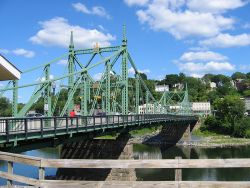
The crossing of the Delaware River at Easton, Pennsylvania, provided a central link in travel from the northeastern seaboard to America's inland territories throughout the 18th and early 19th centuries. From 1806 to the mid-1890s, travelers used a landmark wooden structure built by noted bridge-builder Timothy Palmer. By the 1880s, however, Palmer's three-span covered bridge could no longer handle the demands of traffic generated by new trolley lines.

The Northern Pacific High Line Bridge No. 64, built between 1907 and 1908, has continued to perform yeoman service in the uninterrupted flow of the Nation's commerce. Nearly, 100 years after this bridge officially opened, it still carries 125-ton car unit coal trains, double stack container trains, lumber, and refined products at train speeds of 50 m.p.h.
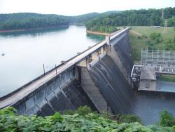
Norris Dam impounds the Clinch River, a mountain tributary of the Tennessee River. The facility stands as a tribute and symbol of the birth of the Tennessee Valley Authority (TVA). Given broad jurisdiction over resource development in the watershed (a 40,000-square-mile basin comprising parts of Virginia, North Carolina, Georgia, Alabama, Mississippi, Kentucky, and Tennessee), the TVA was formed to plan for flood control, improve navigation, and produce hydroelectric power.

Delaware 19709 New Castle State: DE Zip: Country: USA Website: http://www.asce.org/Project/New-Castle-Ice-Harbor/ Creator: Delafield, Richard
In 1794, the Delaware legislature authorized a lottery to fund the erection of ice piers in the harbor at New Castle. The ice harbor was designed to protect anchored ships from storms and ice. At the time, New Castle served as the principal winter port for ships from the Port of Philadelphia because ice on the Delaware River posed such a serious hazard to the wooden-hulled vessels. The harbor was the first of its type on the river and the last one to be maintained as the need for them declined. It served as a model for the other four harbors constructed in the area.

Navajo Bridge spans Marble Canyon, 470 feet above the Colorado River in Grand Canyon National Park. It was considered the highest steel arch bridge in America when completed.
The Navajo Bridge (also known as the Grand Canyon Bridge) was built in 1929 by the Arizona Highway Department and provided a vital transportation link over the Grand Canyon between northern Arizona and southern Utah. Construction commenced by building on one side of the canyon, then on the other, until the two sides met in the middle.
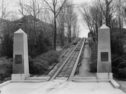
The Granite Railway Company of Quincy was the first commercial railway in the United States. Incorporated in 1826 and designed by Gridley Bryant, the railway relied on horses, rather than steam locomotives, to draw the cars along the tracks. Its primary purpose was to transport granite from…
Read More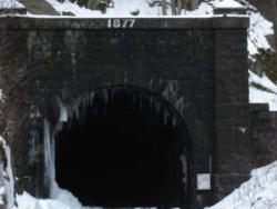
When first proposed in 1819, the Hoosac Tunnel seemed so logical. It would provide an efficient and direct route for the Boston and Albany Railroad, whose pathway meandered 20 miles along precipitous grades. Early proponents, however, could not have imagined that blasting a 4.75 mile tunnel…
Read More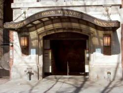
A transportation tunnel under the Hudson River connecting Manhattan and New Jersey was first considered in the 1860s, fueled by New York City's rapidly growing congestion and the inadequacy of existing ferry service to population centers across the river. DeWitt Clinton Haskin, an engineer…
Read More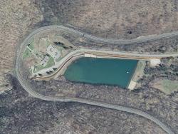
One of the earliest and most impressive of America's great railroad engineering feats, the Horseshoe Curve was built as a means of overcoming a straight-line grade over the geological feature known as the Allegheny Escarpment or Allegheny front, which separates the ridge-and-valley section of…
Read More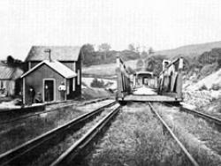
Morris Canal was built to transport coal from the Lehigh Valley of Pennsylvania to industrial markets in Newark and New York. The total length of the canal was 106 miles. The canal climbed an astonishing 914 feet from Newark Bay to the summit at Lake Hopatcong, and then dropped 760 feet to the…
Read More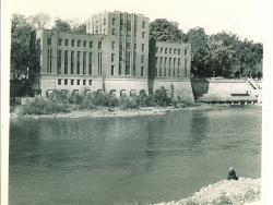
The Hydraulics Laboratory at The University of Iowa, renovated in 2001 and in 2003 renamed the C. Maxwell Stanley Hydraulics Laboratory, is the oldest university-based hydraulics laboratory in the U.S. that continuously has focused on research, education, and service in hydraulic engineering.…
Read More
This is the oldest and most extensive use of terraces in the world. The 20,000 hectares of terraces represent a rearrangement of the Cordillera Mountain Range from bedrock to topsoil. The engineering principles of hydrology, sustainable development, and efficient use of water resources and…
Read More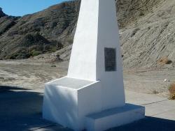
William Emory was an 1831 graduate of the U.S. Military Academy at West Point. When the Mexican War broke out, he was assigned as chief engineer officer to General Stephen Kearny, whose army traversed largely unknown territories in the West. The U.S. War Department would later print 10,000…
Read More
The Watervliet arsenal complex originally was built to house and manufacture weapons for the War of 1812. During the Civil War, it specialized in gun cartridges and artillery carriages. The facility today is a primary site for making state-of-the-art tank cannon, howitzers, mortars, and…
Read MoreThis bridge is recognized as the first iron bridge in the world. This rural region of England was an important industrial area thanks to coal deposits near the surface. In 1776 the nearest bridge that enabled people and goods to pass over the River Severn was two miles away at Buildwas. There…
Read More
"May God continue the unity of our Country as this Railroad unites the two great Oceans of the world."
- Inscription on the ceremonial Golden Spike
The symbolic Golden Spike, staked in Promontory, Utah in 1869, marked the completion of the first transcontinental railroad,…
Read MoreAfter more than 50 years of contention and debate, dredging began in 1911 on an eight-mile channel connecting Puget Sound, Seattle's gateway to the Pacific, to two inland freshwater lakes, Lake Washington and Lake Union. With the completion of the Lake Washington ship channel and Chittenden…
Read More
San Antonio's River Walk, a catalyst for abundant commercial and tourism enterprise, is generally regarded by cities and urban planners throughout the world as a prototype for the development of urban riverfront sites. The River Walk's success, however, would not have been possible without a…
Read More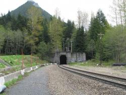
In the years following the Civil War, the land west of the Mississippi River was being settled and the Pacific Northwest explored. There remained, however, a large portion of Montana, Idaho, and Washington that contained enormous quantities of timber and minerals, but was not accessible by rail…
Read More
The tower was designed to rest on a continuous reinforced concrete mat, 4 feet thick, with the base of the slab 24 feet below street level.
What makes the Texas Commerce Bank Building revolutionary in the civil engineering world is not so much the building itself, but its foundation. …
Read More
"Who in Europe, or in America for that matter, knows that Kansas City is one of the loveliest cities on earth? [...] the residential section is a masterpiece of city planning [...]; Few cities have been built with so much regard for beauty."
- Andre Maurois, French author and lecturer…
Read More
The 1.5 mile Lacey V. Murrow Bridge was the largest floating structure in the world and the first to be built of reinforced concrete when completed in 1940. The bridge consisted of typically 300-foot long pontoons floated to site and rigidly connected to form a continuous structure and…
Read More
The Chamberlain is the only surviving bridge of the original five. The others were replaced as the river rose due to flood control dams put in place over time.
For its first 30 years of statehood, South Dakota was effectively two states. The Missouri river cut across the land forming a…
Read More
In 1915, a tropical storm dropped nearly 11 inches of rain on St. Louis in just 17 hours, causing a devastating flood. Claiming 11 lives and the homes of 1,025 families, the flood focused public and government attention onto the problems of the river.
In the early 1900s, St. Louis…
Read More
The voyage of Captain George Vancouver, 1791 -1795, was commissioned by the British Admiralty to map in detail the west coast of North America from Mexico to Alaska and to meet with Spanish authorities on the coast to enforce the terms of the Nootka Sound Convention of 1790.
Departing…
Read More

