Since the beginning of irrigated agriculture, it has been important to measure flows of irrigation water. Accuracy of early water measurement methods often suffered because of trash or sediment in the water, or unusual flow conditions. Ralph L. Parshall saw this problem when he began working for the USDA in 1915, as an irrigation research engineer. In 1922 he invented the flume now known by his name. When this flume is placed in a channel, flow is uniquely related to the water depth.
CO


"Electricity produced here in the spring of 1891 was transmitted 2.6 miles over rugged and at times inaccessible terrain to provide power for operating the motor-driven mill at the Gold King Mine. This pioneering demonstration of the practical value of transmitting electrical power was a significant precedent in the United States for much larger plants at Niagara Falls (in 1895) and elsewhere. Electricity at Ames was generated at 3000 volts, 133 Hertz, single-phase AC, by a 100-hp Westinghouse alternator."
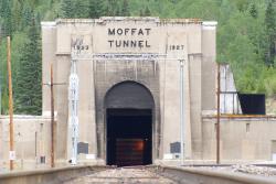
Known as "the highest and lowest holing in history," the tunnel bored through the Rockies at an elevation of 9,200 feet, 2,800 feet below the surface. Eight hundred men worked around the clock for 3 1/2 years, moving 3 billion pounds of rock.
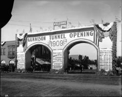
At its completion, the 5.8-mile Gunnison Tunnel under western Colorado's Vernal Mesa was the longest irrigation tunnel in America. It carried water from the Gunnison River to the Uncompahgre Valley to irrigate 146,000 acres of cropland.
Work on the 30,582-foot tunnel was first performed manually. Adverse geological conditions provided great challenge for this pioneering project. The drilling crews had to deal with clay, sand, shale, and a badly fractured fault zone.

The Durango-Silverton Narrow Gauge Branch of the Denver & Rio Grande Western Railroad extends from the town of Durango to the mining camp of Silverton. Built in 1882 through one of the most rugged mountain areas of the nation, its complexity remains a testament to the role civil engineering played in the development of the western United States.
The tracks rise up the sheer, steep Animas Canyon, running along a rock ledge just wide enough to carry the train. The line is used today as a tourist attraction, carrying visitors through the picturesque San Juan Mountains.

Winding over 64 miles through the majestic San Juan mountains, the narrow-gauge railway known today as the Cumbres and Toltec Scenic Railroad was built as a branch of the extensive Denver and Rio Grande Western Railroad that ran through western Colorado and most of Utah. It originally served the large number of settlers flocking to the gold and silver mines of the region.
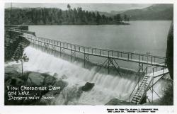
The Cheesman Dam was the first major dam in the U.S. to incorporate the gravity arch, and upon completion it was the highest gravity arch stone masonry dam in the world. It is the key structure in Denver's water supply.
Three years into original construction, flooding swept away the partially completed rock-filled structure. A solid masonry replacement dam was completed in just five years - a major feat for such a remote and complex project. When it was finished, the dam rose higher than the tallest building in Denver.

Four prehistoric reservoirs at Mesa Verde National Park were constructed and used between AD 750 and AD 1180. They are: Morefield Reservoir (in Morefield Canyon), Far View Reservoir (on Chapin Mesa), Sagebrush Reservoir (on an unnamed mesa), and Box Elder Reservoir (in Prater Canyon). These four ancient reservoirs represent extraordinary engineering achievements by the Ancestral Puebloan people. In an arid environment with very little surface water, these prehistoric people found ways to route and capture runoff to create sustainable domestic water supply reservoirs.

This inertia dynamometer is used to test railroad wheels under controlled conditions that can greatly exceed normal service. It is the first and only railroad dynamometer to test track wheels using vertical and lateral loads, as well as thermal braking loads, at the wheel rim. It can also test railway car and locomotive axles.
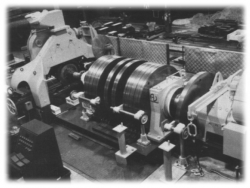
This inertia dynamometer is used to test railroad wheels under controlled conditions that can greatly exceed normal service. It is the first and only…
Read More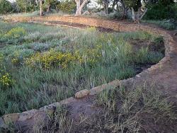
Four prehistoric reservoirs at Mesa Verde National Park were constructed and used between AD 750 and AD 1180. They are: Morefield Reservoir (in Morefield Canyon), Far View Reservoir (on Chapin Mesa), Sagebrush Reservoir (on an unnamed mesa), and Box Elder Reservoir (in Prater Canyon). These four…
Read More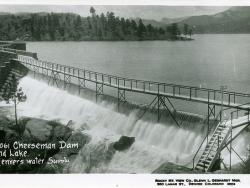
The Cheesman Dam was the first major dam in the U.S. to incorporate the gravity arch, and upon completion it was the highest gravity arch stone masonry dam in the world. It is the key structure in Denver's water supply.
Three years into original construction, flooding swept away the…
Read More
Winding over 64 miles through the majestic San Juan mountains, the narrow-gauge railway known today as the Cumbres and Toltec Scenic Railroad was built as a branch of the extensive Denver and Rio Grande Western Railroad that ran through western Colorado and most of Utah. It originally…

The Durango-Silverton Narrow Gauge Branch of the Denver & Rio Grande Western Railroad extends from the town of Durango to the mining camp of Silverton. Built in 1882 through one of the most rugged mountain areas of the nation, its complexity remains a testament to the role civil…

At its completion, the 5.8-mile Gunnison Tunnel under western Colorado's Vernal Mesa was the longest irrigation tunnel in America. It carried water from the Gunnison River to the Uncompahgre Valley to irrigate 146,000 acres of cropland.
Work on the 30,582-foot tunnel was first performed…
Read More
Known as "the highest and lowest holing in history," the tunnel bored through the Rockies at an elevation of 9,200 feet, 2,800 feet below the surface. Eight hundred men worked around the clock for 3 1/2 years, moving 3 billion pounds of rock.
Three thousand feet under the Continental…
Read More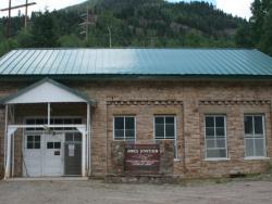
Read More"Electricity produced here in the spring of 1891 was transmitted 2.6 miles over rugged and at times inaccessible terrain to provide power for operating the motor-driven mill at the Gold King Mine. This pioneering demonstration of the practical value of transmitting electrical power…

Since the beginning of irrigated agriculture, it has been important to measure flows of irrigation water. Accuracy of early water measurement methods often suffered because of trash or sediment in the water, or unusual flow conditions. Ralph L. Parshall saw this problem when he began…
Read More

